

The Argis® Lens app for iPhone and iPad
Developer: Argis Technologies, LLC
First release : 02 Nov 2020
App size: 174.91 Mb
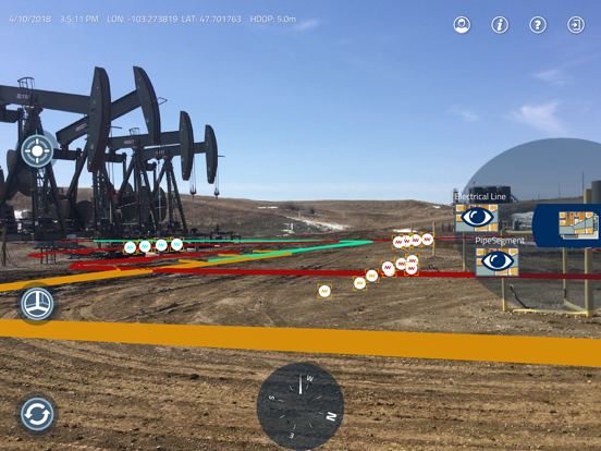
The Argis® Lens helps field operators overcome the limitations of two-dimensional mapping technology when working with underground assets. This app brings ArcGIS data into the three-dimensional world they work in—creating a seamless user experience. End users can locate underground assets more quickly with improved situational awareness, record discrepancies between their current GIS data and known underground facilities for correction, and benefit from an overall increase in productivity in the field while improving GIS data over time.
Key Features of the Argis® Lens:
• The only patented integration of augmented reality with ESRIs ArcGIS platform registered in the U.S.
• Advanced integration is available with Workforce for ArcGIS and other ESRI mobile applications for improved field mobility.
• It is as accurate as the GPS unit used, either with the GPS hardware internal to the device or other Bluetooth GPS options.
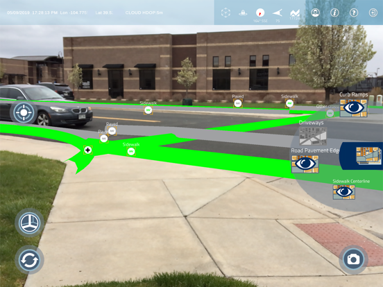
• View ArcGIS online feature services in real time as augmented reality, stable and locked to the ground.
• Edit feature objects within the AR view to update object attributes from the field.
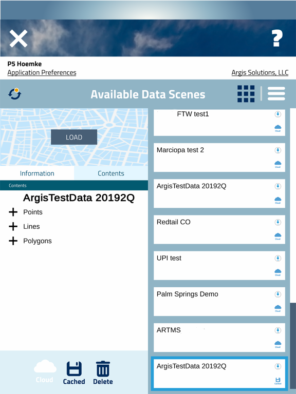
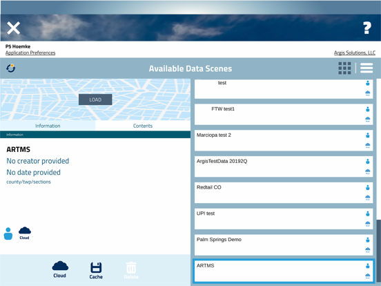
• Cache scenes to the device to work offline or in remote locations.
• No additional hardware is needed to use The Argis Lens.
• Translate ArcGIS data directly in real time using the same color legend and symbology shown in the feature services.
Patented and proven, the Lens is the easiest, most direct way to integrate augmented reality with any ArcGIS implementation.